Author Archives: Sally


About Sally

A Studio Artist and painter trained at Stanford university, Sally has since then graduated from a long career as an Attorney with the Public Defender, and returned to painting. Living in Mexico with her son for a year, they adopted a feral dog, Lety. Sally's son left for college and their dog adopted her new best friend, Steven.

ROCKIN’ THE ROCKIES: IN CANADA, NOT……the USA

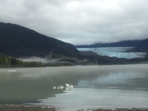
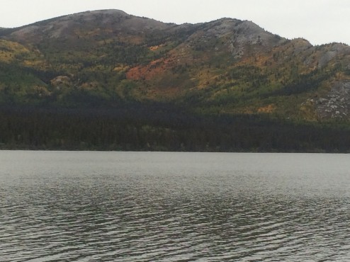
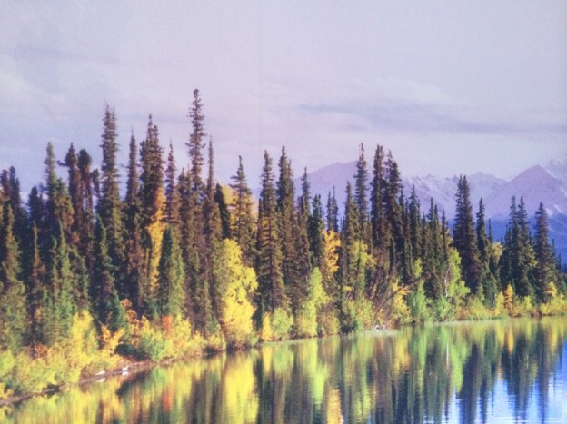
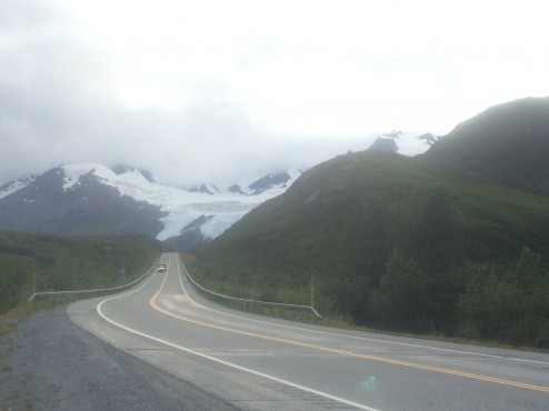
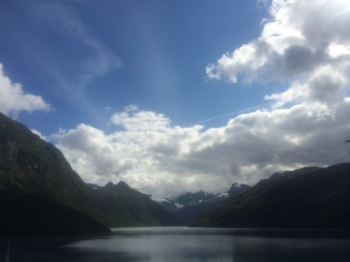
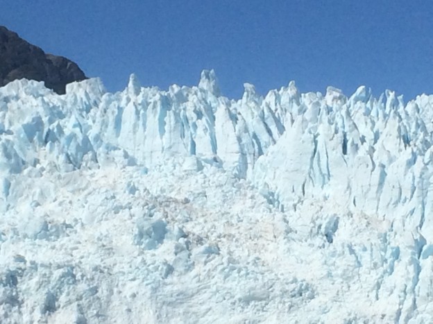
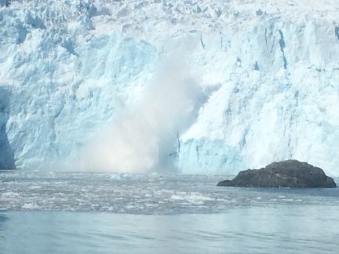
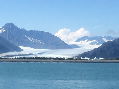
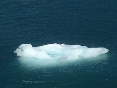
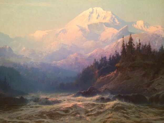
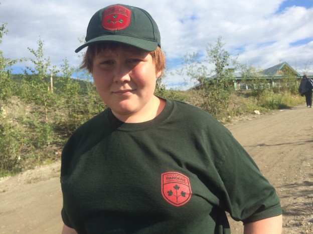
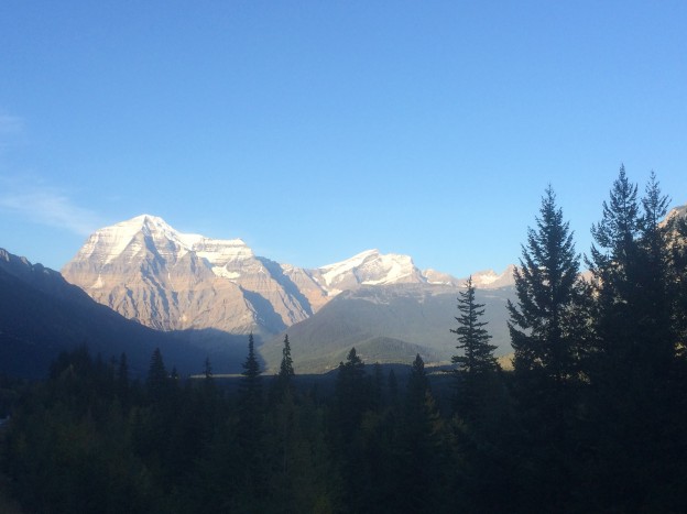
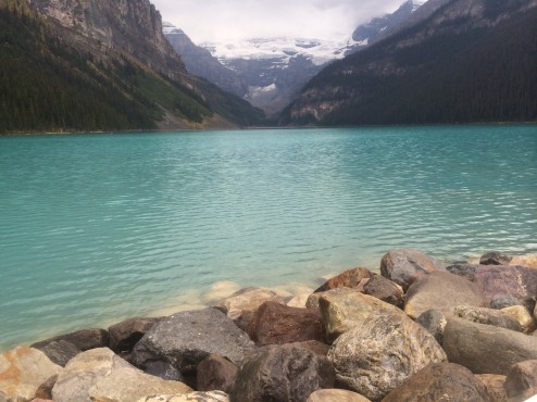
Is there such a thing as too many glacier photos? After three plus months way north, my mom more or less told me it was time to “move on” to other topics. But, but, but….Mt. Robson, the tallest peak in the Canadian Rockies is just too splendid not to show in our feature image. Jasper and Banff Parks offer still more dramatic glaciers (Lake Louise, below).

IMG_2182

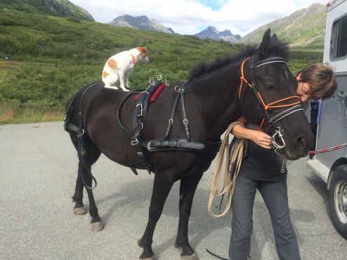
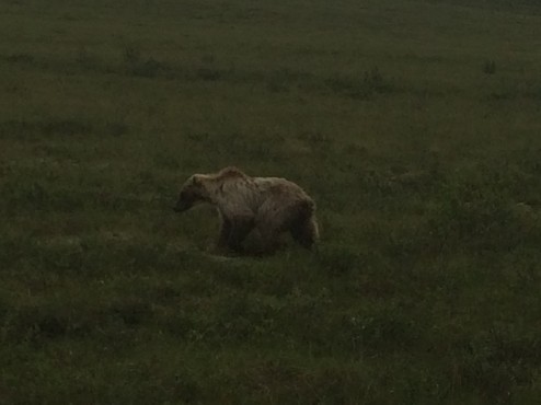
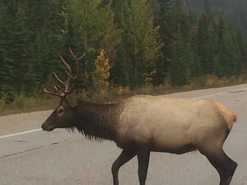
A pair of Elk on the road right in front of our bumper in Glacier National Park, put us closer than any wildlife sightings on this trip.  We greatly appreciate the highways designed with sod overpasses and miles of approaching highway fencing, keeping the large migrating herds of caribou from crossing the highways except at the sod bridges. Safer for all.

IMG_2169

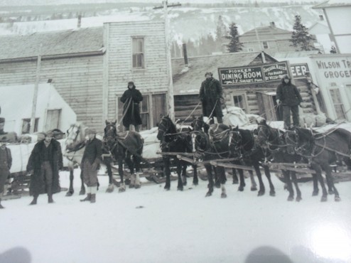
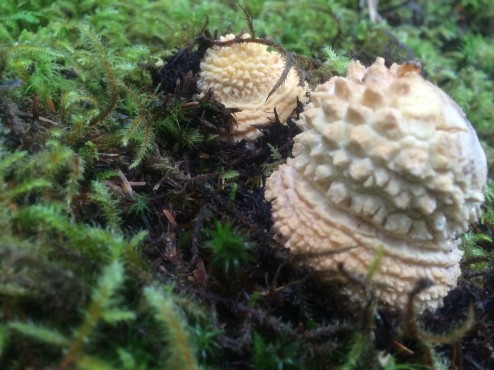
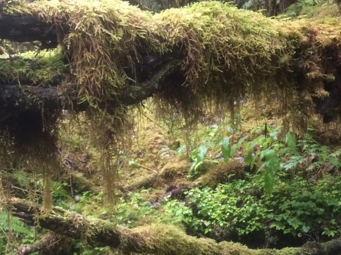
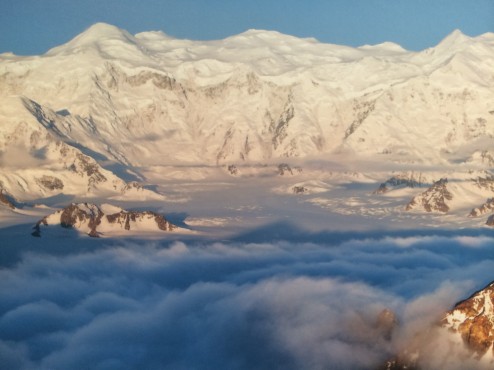
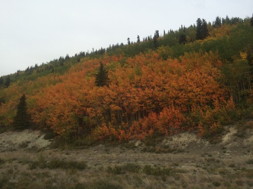
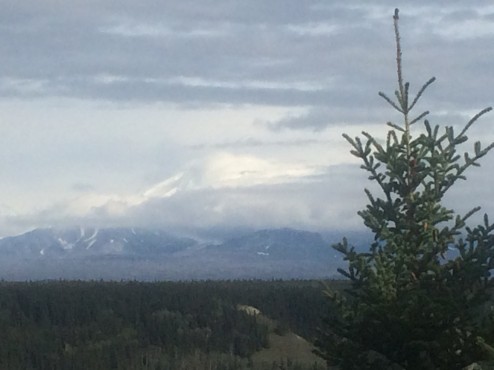
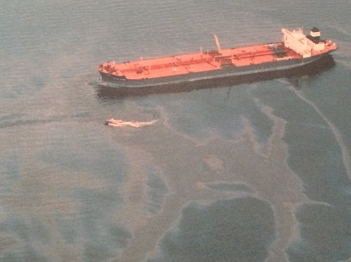
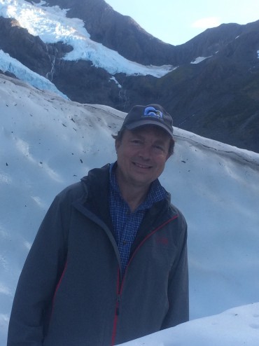
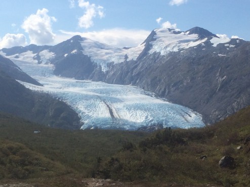
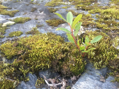
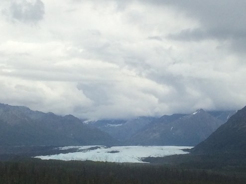
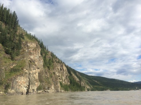
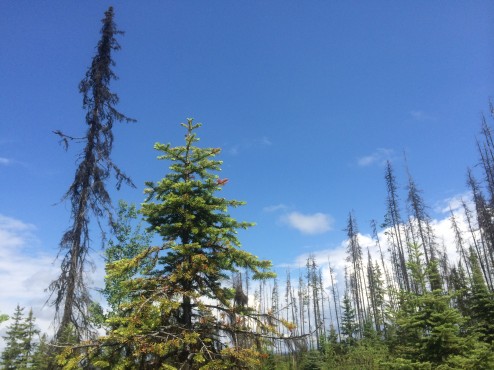
Glacier National Park, Montana, USA will need to rename itself because it is so pathetically lacking in glaciers. We could have a national contest to rename it, “Pretty Nice Park”, or “Happy Animals Park”, so people will enjoy the fall colors, gorgeous waterfalls, and beautiful geologic formations…just not glaciers. With over 150 named glaciers 75 years ago, it is down to only 20 now, and park personnel predict none within a decade. Mostly you see little patches of dirty glacier surrounded by large fields of fine brown silt outlining where massive glacier-filled cirques used to be. We won’t admonish you to go now, instead will encourage you to drive due north to the Canadian Parks to see real glaciers.

IMG_2241

We continued driving south lingering in lovely Sandpoint and Coeur d’Alene, Idaho both with foodie attitude and good wines, and nice settings on the water…and finally headed west for the first time in two months,  only to discover our new ‘small city’ favorite…Spokane, in Eastern Washington. As the Spokane River flows through town, with lovely falls, great bridges and bike trails, we rode bikes to explore lots of outdoor art. With three universities and several large regional theatres (including the Bing Crosby), the town is jam packed with great food, and added cultural attractions for October’s “Art Month.” It feels like a big city (2nd largest in Washington with a population of 200,000) and a small town at the same time.

IMG_2262

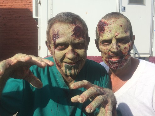
We loved meeting these extras, just exiting the make-up trailer on a shoot near our hotel. What’s your guess, another Zombie movie…or just another day in Spokane?

IMG_2241

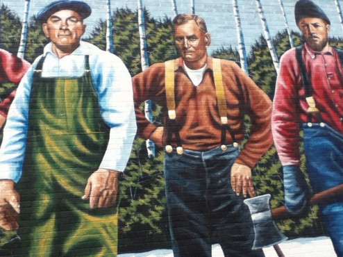
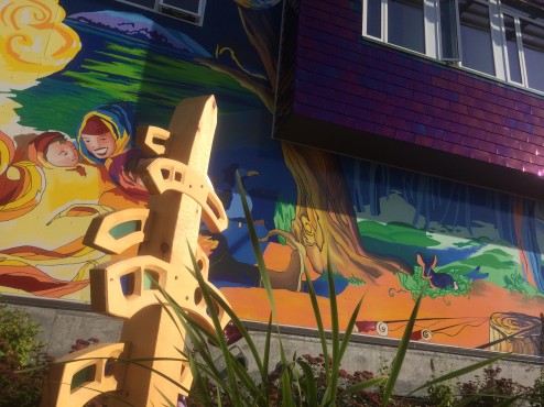
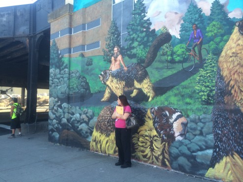
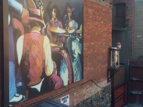
Spokane is a train town and they roll through, throughout the day and night. Many of the underpasses have become graffiti’d pee stops and homes for vagrants. In 1993, local artist Tom Quinn (www.quinntheartist.com) contributed a 20 ft. tall wall mural of oversized Hoary Marmots…and the Marmot became the town’s informal mascot. With time the mural faded and became obscured by bird poop and vandalism. Above is Tom’s replacement Marmot mural, painted at the City’s request this time, instead of as free form public expression.

IMG_2243

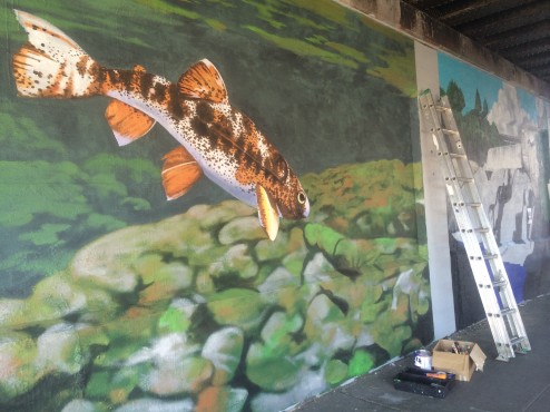
I happened on Tom painting new murals in the underpass and he was able to tell me the provenance of the murals (below) seen from our bed at the very groovy Ruby Hotel: muralist Ric Gendron. I am sorry I am not able to credit the creator of the wee bather in the adjoining wall sculpture or the muralist in the under pass at the bottom of the blog.

IMG_2261

It took me a moment to figure out why the area’s designated Smoking Area seen above, specifically stated, “No Marijuana Smoking”. Duh. Recreational use of Marijuana is legal in Washington…but not in public spaces. The City of Seattle Police Chief last week dismissed 80% of the citations issued for public marijuana smoking, because it was the personal crusade of one officer who wrote all of those tickets. We’ve never been to Colorado or anywhere recreational marijuana is legally available to the general (over the age of 21) public. Of course, in our investigative journalistic quest, we visited a dispensary, only to find it…sold out! Darn! We were fantasizing about the brownies!

IMG_2265

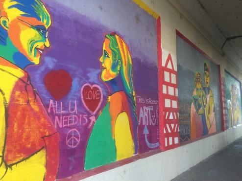
Anyway, it is time to continue driving west, then south into other western states with old-fashioned rules about marijuana, and standard, ‘virgin’ fudge brownies…not that there’s anything wrong with them, as Seinfeld would say. We say, “All you need is love…la…la…la,la,la…”


THE ALASKA HIGHWAY: NOMENCLATURE

At the start of our trip we stated we were at the real “Mile Zero” for the AlCan Highway based on the theory prevalent in Weed, CA:  Hwy# 97 in Weed runs north as Hwy # 97 through Oregon, Washington, British Columbia, the Yukon, and Alaska, and parts of it are referred to by all jurisdictions as the Alaska or Al-Can Highway.

IMG_0329

55,000 signs contributed by drivers on the AlCan Hwy in Watson Lake, BC, Canada.

Dawson Creek, British Columbia, Canada also claims to be “Mile Zero” for the Al-Can…as does Edmonton in the Alberta Province of Canada. Also Fairbanks, Alaska likes to claim it is the Northern Terminus of the Al-Can. So who are you to believe? Where is the real start and end of the Al-Can?

IMG_3129

It turns out the original AlCan was called the Alaskan Army Highway as it was built by the U.S. Military during WWII. In June of 1941 the Japanese Army invaded the Aleutian Islands in Alaska. It took a year for the American Army to begin a campaign to retake the Islands. That campaign has been called, “The Forgotten Battle” because it was occurring at the same time as the famous Battle for Guadalcanal. A supply route too far east to be reached by the Japanese Air Force, needed to be built. Long straight road surfaces were avoided to ensure that an invading air force could not strafe an entire convoy. Some of the original road was  improved and straightened once a defensive purpose was not part of the engineering goal.

IMG_3411

The crew who built the Alaskan Army Highway in 1942 had to build new road through the wilderness northward beginning in Fort St. John, because existing (rough) roads to Fort St. John from the South (Dawson Creek, BC) and the East (Edmonton, Alberta) were already in place, just needing improvements. The crew had to painstakingly build 1,422 miles of new road in only two years from Fort St. John all the way to Delta Junction, Alaska, where the road north to Fairbanks already existed.

IMG_0330 I suggest we let the original road builders decide what is the starting point and the ending point of their construction. Although the building crew also IMPROVED the existing road up to Fairbanks, the road east to Edmonton, and the road south to Dawson Creek, the original crew would say “Mile Zero” began in “Zero”….their name for Fort St. John, likely the true southern terminus of the Alaskan Army Highway. The City of Weed, CA promised a matching totem pole at Delta Junction…but it is a myth…just some nice moose sightings just outside town.

IMG_3414

Only Fairbanks, Alaska disputes the identity of the Northern Terminus in Delta Junction. Again, for the road builders, their new road ended in Delta Junction; their work further north was just improvements made to existing road.

IMG_0757


LAND YACHT RIDES THE MARINE HIGHWAY: INSIDE PASSAGE-ALASKA

Change of plans.

IMG_1988

Travel fatigue kicked in at 3 months, instead of at the 13 month mark, like our last road trip. Is it because we couldn’t get satisfying access to a massive world heritage site we drove past for days and days, with few photos, and mediocre views, after steep hikes on rough terrain? Is it because our minds were blown every day with the dramatic Arctic scenery in Canada, followed by amazing wildlife, volcano and glacier viewing in Western Alaska so our EYES are tired…or is it the mass of biting insects (in their third hatch!) due to the especially wet summer?

IMG_1948We think the fatigue is probably explained by our bodies’ difficulty acclimatizing to 24 hours of sun all day and night in July at the Arctic Ocean, to Autumn’s freezing, dark nights with Aurora Borealis and howling wolves only 6 weeks…and thousands of road miles later, in August. Certainly our new rig with the queen size bed leaves no excuse for not sleeping well. Maybe we just need a daily dose of competitive tennis to keep us vibrant, and of course, there are few courts to be found in tiny Alaskan hamlets with long severe winters. When we find them, they are made of cracked asphalt (no cement in the land of the deep freeze), with barely visible lines, sagging nets, usually wet…and we love playing them anyway.

IMG_2106

Whatever the reasons, we are taking a break from asphalt and gravel highways, opting for “free-style cruising” courtesy of the Alaska Marine Highway; at the last minute we jumped on a southbound ferry from Haines, Alaska without reservations to let the ship’s Captain do the driving. We have been driving our rig off ship to explore the towns, glaciers, hikes, and wildlife in the Inside Passage for days at a time, sharing the water with the early morning fishing boats.

IMG_2123

Although more expensive than driving our 23 mpg rig on the supposedly beautiful Cassiar Highway south, we’ve enjoyed daytime ferry travel with hot showers and kitchens to cook our food, and whales and porpoise pods for company as the ships travel through narrow steep fjords. On the overnight ferry trips, we have no access to our land yacht, and sleep out on the deck with other, usually younger, adventure travelers. So, who needs a cruise ship?

IMG_2133

The towns of the Inside Passage are all year round commercial fishing villages, and seasonal tourist traps where the cruise ships visit. Yet they each have their unique charms: Ketchikan is the seaplane capital with aircraft, ferries and cruise ships sharing the waterfront above.

IMG_2062

In Juneau, the Alaskan Capital, we enjoyed camping on an iceberg strewn lake before the Mendenhall Glacier at the edge of town (above)…but really, a State Capital with no railroad or road access? All of the Inside Passage is abutted by the Tongas National Park…dripping with rainforest. The hiking is extraordinarily beautiful, with lots of pesky bears fishing in the creeks (you don’t need a fancy tour to find sows and cubs chowing down!). All you need is your rain gear and your muck boots, to contend with the 55 inches of rain the area gets every October. You can see at the top and below, the happy mushrooms and furry green landscaped carpet.

IMG_2036

Some of these towns are weirder than other. We loved Haines, Alaska with the Hammer Museum, displaying a rock hammer used to build the Mycerinus Pyramid at Giza in 2500 B.C. When the rocks made of dolerite (hard, igneous rock) were used to cut blocks of softer limestone, they eventually chipped down to small round rocks themselves. Abandoned until archaeologists determined their purpose in a recent dig, one sits amid hammers for specific purposes like watch repair, horseshoeing, metal work, fire hydrant release, and animal husbandry, ones with printed names from nightclubs like the Cotton Club, given to patrons to “ding-ding” on their glasses for a fill. Thousands of them. Amazing collection by one passionate collector. Alaskans!

IMG_1898

Our best experience in Haines was catching a performance of the African Children’s Choir from Uganda at the local public school our last morning. The school is a K-12, tiny, with only 20 graduating seniors each year. All the students seemed enthralled by the age 9-12 drummers, singers and dancers in kente cloth.

IMG_1908

Haines, Alaska raises funds for Africa’s Kilimanjaro Orphanage, founded by a local Haines physician and run by a Haines Board of Directors. Like the children at that orphanage, these performers have lost their parents to AIDS. After the one year tour of the U.S. and Canada, these children who have become like siblings to each other, will stay together at a boarding school for the duration of their childhood. Talented ambassadors for Uganda.

IMG_2069

In Prince Rupert, we will leave the marine highway, and Alaska, and take to the paved one, for the long ride home…we hope before the snow starts. There really is nowhere like Alaska where almost 90% of the state is dedicated to public land. We’ll be back.


PROTECTED BY INACCESSIBILITY: KLUANE AND WRANGELL-ST.ELIAS NP

If you aren’t a long distance backpacker, climber, or kayaker, you can only touch the edges of these parks. Even a coastal assault does not provide easy access to the park interiors. Furthermore, taking hikes up slippery and steep, scree filled faces, from the perimeter roads, and then being able to see one small glaciers and one lower peak in the distance on each hike is more painful than pleasurable. However, driving for days down the paved highways along one long side of the extended three park World Heritage site, leaves us staggered by the enormity of these parks.

IMG_1777

The most northern and the largest park in our National Park System, Wrangell-St. Elias NP contains 13,000 square miles of untouched wilderness. It is also the largest glacial system in North America, 25% of it covered by glaciers. 7 out of 10 of our largest U.S. parks are in Alaska. Mt. St. Elias, only 10 miles from tidewater, is only 600 feet lower than Denali, the highest mountain on the continent. The Bagley Icefield in the interior represents 60% of all ice-covered terrain in Alaska. Although the Park has World Heritage Site status, it is currently not a draw to tourists, given the access issues. Long, pot-holed dirt roads get you to one small glacier, but not to views of the ice fields and tall peaks we want to see. Not that glacial lakes aren’t a pretty place to camp…

IMG_1846

However, our biggest disappointment was not being able to see Mt. Logan in Canada’s Kluane Park (pronounced “cloo-AH-nee) . Mt. Logan is the highest peak in the largest massif mountain structure in the world. It can be seen best in the featured image of a relief map of the massif, and also in the uncredited flight-seeing photo below. It has the largest base circumference of any non-volcanic mountain on Earth. It is over 12 miles long and has over 200 glaciers. It contains 11 peaks over 16,500 feet…and the mountain is still rising. It is frozen year round, leaving an ice cap 1,000 feet thick in places. In geology, a massif is a section of the planet’s crust that retains its internal structure while being displaced as a whole. The Swiss Alps and Himalayas containing Mt. Everest are an example of these massifs, as is ‘The Face’…on Mars. Again, the World Heritage Site designation is not a draw for tourists so long as access is so limited. Just to give you a sense of our frustration, the Mt. Logan massif is not visible from ANY perimeter road, no matter how clear the weather.  Only 2,000 feet taller, Denali can be seen most clear days from Anchorage to Fairbanks. This massive beast requires good weather AND an airplane. We had neither.  “Grrrrr!”

IMG_1849

The next Park to the South is the Tatshenshini-Alsek which is accessible by river. Running “The Tat”, is something we’ve heard river running friends talk about for years…big Class 4 waves and very cold water in deep wilderness, as the two eponymous rivers meet up. Again, you have to commit yourself to a 10 day or so rugged trip to enjoy the interior of these parks. The most frustrating experience is being unable to see, much less shoot cognizable photos of these amazing peaks due to poor weather and poor accessibility. I guess we just have to return, not during the rainy season, and when we are ready to commit 10 days to adventure travel…in each one of these parks.

AUTUMN IN AUGUST: INTERIOR ALASKA

IMG_1833

AUGUST 28. We left sunny Valdez during the last few days of the Fishing Derby, crazy with happy anglers pulling the last Silver Salmon and Halibut of the season. One hour later we were on the Worthington Glacier at Thompson Pass.

IMG_1770

On the Eastern side of the Pass, one hour later, Summer was over, and we met Autumn…near freezing nights, aspens and birches aflame with color, and the call of wolf packs traveling the ridges at night. The Volcanos of Wrangell/St. Elias National Park (the largest NP in Alaska) like to hide behind clouds, even the smaller 12,000 foot Mt. Drum below.

IMG_1781

At Kluane National Park, last night, we saw our first Aurora Borealis. Not the pink and purple swirls of the dramatic photos, but still amazing to us at 3 AM even in pale gray-green. Like the migrating birds, we are heading south with alacrity now as we are told it would not be unusual to get snow in two to three weeks. In fact, we hear that our HMO Kaiser-Permanente uses the array of influenza viruses that present themselves in Alaska in August as the basis for their choice of influenza viruses to attack in Winter in the lower 48. In the meantime, we Californians are really enjoying the autumn foliage and crisp air as a novel, dramatic, and unusual season.

IMG_6933

YOU KNOW HOW TO PRONOUNCE IT: VALDEZ, ALASKA

Most of us following the news in 1989, learned a lot about Prince William Sound, and the oil tanker Exxon Valde-e-e-e-e-z. That was a pronunciation hint just in case you gave it the standard Spanish pronunciation or you weren’t paying attention to one of the most devastating human-caused environmental disasters. It was the largest U.S. oil spill until the 2010 Deepwater Horizon spill in the Gulf of Mexico…and taught biologists a lot about how NOT to deal with a massive oil spill.

IMG_1372

The oil originally came by pipeline from the North Slope (at the Arctic Ocean), traveling 800 miles to Port Valdez.  Loaded with 55 million gallons of oil, the Exxon Valdez grounded on Bligh Reef 30 miles from port, spilling between 11 million to 32 million gallons of crude oil over the next few days, depending on who is counting and their methodology. Oil covered 1,300 miles of coastline, and 11,000 square miles of ocean. Only 10% of the oil was recovered at the time as kelp clogged pumps, explosions (effective but relying on toxic chemicals) were halted by bad weather, and the biggest mistake, high pressure water blasting of the coastline, scoured off the organisms that assist with oil removal; 100% clean is not the goal of oil spill clean-up anymore due to its’ destructive impact. Because ExxonMobil’s pre-existing emergency response was inadequate for a spill of this size, the oil dispersal was rapid and long-reaching. Immediate effects included the deaths of 250,000 seabirds, at least 2800 sea otters (the slowest mammal to recover), 12 river otters, 300 harbor seals, 247 bald eagles, 22 orcas and an unknown number of salmon and herring. All of the populations have come back, except for the herring population.

IMG_1721

Eleven years later, more than 23,000 gallons of oil remained in the sandy soil of the contaminated shoreline, declining at a rate of only 4% per year; this rate is remaining steady to the present. Although ExxonMobil had argued that the $507.5 million punitive damages eventually ordered by the court were not justified as the ship’s grounding constituted an “accident”, the fact that the inebriated skipper with a known history of substance abuse was put in charge of the tanker in the pristine Prince William Sound, supported a finding of responsibility.

IMG_1365

Costing $8 billion, under construction for 3 years and 2 months, and having up to 28,000 employees working at once, the pipeline is the world’s largest and most expensive private engineering project. Insulation and passive cooling systems are in place above ground at each of the 78,000 vertical supports for the 420 miles of above-ground pipe. Over 380 miles of pipeline nestles underground in the thaw-unstable permafrost and requires recirculating frozen materials to protect the permafrost. The pipeline zig zags to allow for the movement of the pipeline during 5.5 Richter Scale earthquakes in the far north, and 8.5 in the last 90 miles approaching Valdez. At the Denali fault, the shoe slides seen above are 20 feet wide to allow maximum ‘wiggle’.

IMG_1371

The pipelines are serviced by “Pigs” (scouring pig seen inside pipeline above, safety testing pig ready for insertion above to check pipe thickness and integrity with ultrasound waves). Pigs fit within the 48 inch diameter pipeline, and move through the pipeline from its’ placement in the pipeline at the first pumping station near the Arctic Ocean until it is removed in Valdez 800 miles later.

IMG_1370

The planning and engineering required to build an entity which can monitor up to 85 million gallons of oil a day through 800 miles of rough terrain and underground passage, across 3 mountain ranges, including the continental divide and Atigun Pass at almost 5,000 feet, and never have any earthquake caused oil spill in its’  history is amazing to contemplate. Imagine if we gave 3 years of complete attention (and funding) by the best engineers in their fields to solve problems like global warming, eradicating preventable disease, or global access to clean water and sufficient food. Other than global warming, we really could accomplish these goals. However, without our increasing fossil fuel demand and corporate profit motive, do you see such progress occurring, in spite of our ability to accomplish the goals?

IMG_1728

In 1976 Alaskan Governor Hammond wisely fought Big Oil and federal interests to legislate the establishment of the ‘Permanent Fund’ whereby the State holds profits in Trust for citizens, doling out dividends yearly, as low as $300 per resident some years, and up to $2000 this year. Surprisingly, Sara Palin as Governor was a moderate who worked with the Legislature to enact taxation on Big Oil’s profits. Unfortunately, when she abandoned office to become a Tea Party candidate, her Lieutenant  Governor weakened the taxation laws, and public services had to be slashed to deal with the resulting deficit. Legislation to reinstate the Corporate Tax was defeated recently when Big Oil outspent the proponents of the Proposition by 50 to 1. She has since moved to Scottsdale, Arizona. The Anchorage paper reported a poll released 3 weeks ago showing 36% of respondents viewed Palin favorably, versus 55% who viewed her negatively. Locals tell us they didn’t really understand how silly she was nor her Tea Party agenda to help the rich get richer until her national campaign for Vice President; now they say she couldn’t win any election in the State of Alaska, even if she still lived here, as she does not represent your average citizen, only the rich ones….Joe the Plumber, Ha!

IMG_1670

Fortunately, legislation is in place to protect Prince William Sound from another massive spill; each ship’s history of oil spills is reviewed before it can enter the Sound. The risk may become moot as the North Slope oil production is decreasing day by day. They are already discussing how they will dismantle the pipeline as required by 1300+ state and federal permits needed before construction could begin. About half of the pumping stations are off-line due to the decrease in the volume of oil passage.

IMG_1433

Governor Hammond was smart to see the long-term picture and set up the Permanent Fund to benefit citizens, only after the State needs were satisfied. Alaska residents can get a college degree from University of Alaska in Fairbanks, Anchorage or Juneau for…$2000 a year. Very good planning by both Governors…until one of them sold out. At least Tina Fey’s career got a boost with the comedic material Sarah Palin provided during the campaign. Pretty funny that the State known for the largest Libertarian Party in the US (a majority of Alaskans, best described by their opposition to following ANY federal mandate or law) …get more federal funding than any other state.

IMG_1695


BUCKET O’ BUTT: SEWARD, ALASKA

Besides our amazing U. S. Constitution, the National Park Service might be our second greatest American contribution to the world. Not only does it steward priceless lands like Kenai Fjords National Park, but also makes them accessible to the public, and provides education to enhance our enjoyment. Kenai (pronounced like ‘be my’) NP protects the Harding Ice Field which makes up 50% of the 670,000 acre park. The rest of the acreage is the detritus thereof: glaciers that flow as fast as your nails grow, carving steep sided fjords, and providing scoured rock for temperate rain forest to grow where glaciers have retreated. The eerie sound of glacial moaning and creaking as it melts and shifts with heat and gravity, proceeds the gunshot-like crack of the calving glacier, seen as a 40 foot splash below at Holgate Glacier.

IMG_1542

The first to populate after glacial retreat are the pioneers, the Lichens. Lichens use fungi biology for structure and to reproduce with air borne spores, use algae biology for photosynthesis, and also secrete an acid that breaks down rock to make dirt. Plants then fill in, in the following order as each provides a platform for the next life form: moss, nitrogen-fixing plants like lupines and fireweed, shrubs like alders and willows, cottonwood, and finally when sufficient soil is developed, the Sitka Spruce. Even the salmon returning to their creeks help out as bears, birds, and other animals eat them, and spread salmon fertilizer across the forest floor; salmon DNA has been found in the top of the tallest sitka spruces. The photo below shows lichen, moss, fireweed mulch, and an alder shoot, grabbing for life onto bare rock recently covered by the Exit Glacier, reachable by a short hike.

IMG_1666

One examples of extraordinary NPS contribution to education was the visual display showing the Exit Glacier’s rapid retreat, with signs on the entry road every 1/8th mile, showing the Glacier’s many miles of retreat, from 1850 to the present. Surprisingly, there was no information on the human contribution to the Exit Glacier remarkable retreat. Instead, we searched for recent research on glacial retreat in general since 1850 and found an article by scientists at the University of Innsbruck in Austria published in the journal, Science Express. For the period from 1851 through 2010, they calculated the human contribution at a quarter, “In the 19th and first half of the 20th century we observed that glacier mass loss attributable to human activity is hardly noticeable but since then has steadily increased”. The researchers used a computer model and global inventory of glaciers to analyze changes in their ice content from 1851 through 2010. That enabled them to separate out the human influence on melting rates from natural ice loss due to variability in solar radiance and volcanic eruption. They concluded that, “the human contribution to melting glaciers is quickening, and now accounts for more than two-thirds of the ice lost world wide”. Wow….more, scary and definitive proof of global warming, caused by our own human practices.

IMG_1644

Global average temperature has warmed by 1.4 degrees Fahrenenheit since 1850, according to the United Nations, which projects temperatures will rise by as much as another 4.8 degrees this century. That would be the quickest shift in the climate since the last ice age ended about 10,000 years ago. Glacial melt “has been a major cause of sea-level rise during the 20th century”, state the researchers. The world’s glaciers contain enough water to raise sea levels by 16 inches, according to the United Nations. Wow. 16 inches, and that is not even considering the far slower melting of the Greenland and Antarctic ice sheets that could elevate sea level by another 216 feet. There is no question anymore that we humans have screwed ourselves with our fossil fuel use, and methane production from animal based industries, causing worsening periods of drought, severe weather, and likely increasing coastal flooding. Get out there and enjoy your glaciers while you can….and don’t buy property too close to the ocean.

IMG_1537Nearby fishing town Whittier, also offers short glacier hikes to Byron Glacier, and up to Portage Pass to overlook Portage Glacier, and iceberg filled Portage Lake. However, our best experiences were by boat, out of Seward. Not only did the NPS provide us with a great Ranger/biologist, but the staff scooped a bergie bit (above) to make us iceberg margaritas…once we cleared the rougher seas in the Gulf of Alaska. That 8 hour day on a fast boat, south of Resurrection Bay, we saw the following: breaching pods of humpback whales x 4, bald eagles, puffed and horned puffin, kittiwake, murre and red-faced cormorant colonies on the cliffs, rafted-up sea otters, Dall’s porpoises surfing our bow wave, smelly sea lion colonies, harbor seals strewn on the ice, and red sea stars creating a defined wide black mark running along the entire coast, where they have eaten away almost all of the intertidal sea urchin population (below). Even the staff said when we were surrounded on all sides by huge, humpback whales exhibiting learned fishing behaviors like loud fin-slapping, it was the best wildlife viewing day of the summer. Lucky us! Another boat trip near Alaska’s 2nd largest glacier, Columbia Glacier near Valdez, paled when compared to our day with our National Park Service Ranger, Rebecca.

IMG_1622Best of all though was watching some unidentified underwater predator drive the fish into a tightly packed, defensive “fish ball”, creating a mob of gulls on the surface attacking a yard in diameter on the surface of the water, only to have them suddenly disperse as a humpback whale swallowed the fish ball whole, as a tasty bundle. We walked home from the boat, to our own fish ball, a “Bucket O’ Butt” (that would be a bucket of fried, fresh halibut), while we sat with our dinner and wine at our waterfront home in Seward, watching a sea otter feeding on shellfish 20 feet off shore for two hours…every evening. Sweet!

IMG_1476Seward rocks!…in summer. It had a beautiful new library and painted murals throughout town (below). In winter, 25 of the 30 restaurants are closed, the population drops to 2500…and 500 of those are incarcerated inmates at Alaska’s maximum security prison across Resurrection Bay from Seward, approximately behind the freighter in the photo above. Only one person has escaped from there, in winter, and turned himself in within a week; ‘freedom’ was just more snow, glacial water, and ice, minus the “3 hots and a cot”.

IMG_1651

DENALI DENIAL: CONSPIRACY IN THE ALASKA RANGE

Do you recall the goofy Holocaust Deniers who profess that Hitler didn’t really kill 6 million Jews. “It is all propaganda!”, they say. We are wondering if we should form a ridiculous organization called, “Denali Deniers”, to reflect the mass of propaganda suggesting you can view the 20,000 foot Mt. McKinley during the summer…just to lure tourists north of Anchorage. We featured this famous painting of Denali by Laurence, because we have not caught even a glimpse through the clouds after 4 weeks camping in the Alaska Range trying to see Denali from the North, East, and South. Local bush pilots say business is horrible this particularly wet and overcast summer as they honestly tell customers they will not see the tallest peak in North America in a flight around the summit. Fortunately the 4 mile wide Matanuska glacier is gorgeous and accessible by car, and the mosquitoes are less pesky than usual. So we’re told. Maybe that is Alaskan propaganda too. IMG_1264 With so many ranges nearby to Anchorage (Alaska featuring Denali, Talkeetna, and the volcanic Aleutian Range) there are lots of peaks. When situated by the ocean, even measly 10,000 foot volcano Mount Illiamna is breathtaking. IMG_1471 Yep, like cabbage, everything grows bigger here! Prehistoric cats, beavers and Mammoth Primigenius. IMG_0576 We feel excited to be on the eastern area of what used to be called Beringia. The Mammoth Steppes were the exposed parts of the Bering Sea when the last Ice Age sucked the ocean water into Glaciers. Beringia (mapped in green, below) remained the grassy home to Wooly Mammoths, Homo Sapien Sapien (the first humans in North America), and other mammals that crossed the Bering Land Bridge like our ancestors. The Mammoths, 14 feet tall with molars the size of shoe boxes, ate 700 lbs. of grass daily. As the grass disappeared, 11,000 years ago, so did Mammuthus Primigenius. The skills these First Americans devised to survive the severe environment included game surround and drive hunting, food preservation techniques, control of fire, constructed dwellings, stone and bone implements, and tailored clothing. These Ice Age Upper Paleolithic Eurasian-Beringians created a rich archeological record and then adapted over the centuries to environmental changes. I hope we have the same creativity and adaptive abilities as our ancesters…and don’t go the way of the wooly mammoths. IMG_0581 Other than ‘killah’ Southern BBQ (‘Bad to Da Bone BBQ’ sold out of a filling station convenience store!) we didn’t find much to extoll about Fairbanks, AK in summer. The military presence (27,000 U.S. Armed Forces in Alaska, especially dominant in Alaska’s second largest city of 30,000 residents), a preponderance of big box malls, and skid-row downtown area is surprising. The University of Alaska is here and these -40 below winters means people are inside making art, so where is it displayed? We imagine returning in Winter when covered with snow, under the Aurora Borealis, and with a view of Denali…if it really exists.

Our 19 ft Roadtrek RV camped across from West Fork Glacier

Our 19 ft Roadtrek RV camped across from West Fork Glacier on the Denali Highway

On the other hand, wet summer weather is more normal in Anchorage in August; the fascinating Anchorage Museum, good restaurants, 50 tennis courts, The Chugach mountains edging town for hiking, lots of bike trails, outside concerts (free!) and happy people outside enjoying 20 hours of daily light, make this city of 300,000 surrounded by sea and mountains, a great place to visit in Summer. It is much warmer in Winter due to the marine environment, but still has months with only 4 hours of light a day. On the other hand, the ski slopes are lighted up nightly until 10 PM for skiing after work! IMG_1452 5 hours away by car, Homer is filled with artists and galleries. While Steven worked hard in a watercolor technique class, I chatted up the locals and hiked marshy trails in search of wildlife. Other than moose, I met up again with the noisy and guttural sandhill crane, except this time they are in every ditch and pond, and even blocking traffic in Homer. IMG_1428 Homer is filled with anglers due to salmon and halibut, and there is plenty left for the bald eagles…until the pesky gulls slowly encroach on the kill forcing the eagle to fly off for more fishing and a quieter dining spot. IMG_1412

MUSH!! : DENALI HWY & FIREWEED LOVE

Yet another mud and gravel road with a sea of potholes…yet the views of Alaska Range peaks, deep valleys supporting herds of caribou, and glaciers, are too stunning to bypass. Originally the Denali Highway was the only access road to Mt. McKinley, AKA Denali, and now is mostly used by hikers, hunters and fishermen. The local dog mushing race, “The Double Denali”  is run along this highway…and back, as it is closed by snow all winter. We hope to return in February 2016 to volunteer with the Race and to support the local 4x Iditarod champion Jeff King (signed racing bib below).

IMG_1263The Iditarod is 1049 miles (the final 49 in honor of the 49th State!) and takes about 9 days. Those amazing dogs! We see them out on the trails here in summer, and they love to pull! Imagine watching them streak across the white expanses, and catching the Aurora Borealis a few hours later in a cozy lodge…

IMG_0571

Alaskans strike us a bit like Texans. Crazy, and Funny. Predominantly Republican, “Dont’ Tread On Me” being the dominant credo, enjoying their guns, meat and booze, Alaskans are a hoot! Maybe their State’s size in relation to other U.S. States explains their similarities: Alaska however more than doubles Texas acreage, and is five times bigger than California.

IMG_1346

Alaskans are very passionate about their interests, and we have really enjoyed their generous dispersal of information, whether we wanted it or not. They are insane about their animals and gardens. Many fish daily to ensure fresh fish for their sled dogs in all seasons.

IMG_1290

Even little villages have gorgeous hanging baskets everywhere. The downside for produce lovers is their passion for “BIGNESS”. The vegetables we bought in the local Farmer’s Markets have been huge…and tough. The largest cabbage, weighing in at 127 lbs. was grown in Wasilla, AK in 2009, with the tight balled head measuring over 24 inches in diameter! Six foot tall Steven stands behind an accurate rendition of the winner to give you an idea of the size of the Monster Cabbage.

IMG_1345

The lichen, fungi, and wildflowers go crazy with 24 hours of summer sun daily and lots of water, but none so much as the Fireweed. Growing tall pink spears in every bog, highway ditch and trail, it didn’t surprise us to find this young man expressing his passion with Fireweed petals, near a beaver pond we found on a popular hike.

IMG_1276

We couldn’t resist a Fireweed Love Selfie…

IMG_1284


YUKON DO IT! MOOSEHIDE GATHERING

Our return on the Dempster Highway again reminded us that this is the most beautiful road we’ve ever driven, even if it is 1000 miles of mud and gravel roundtrip to Inuvik, near the Arctic Ocean. We did get to see grizzly bears up close, just the way we like…from the safety of our vehicle, and not at all on the Grizzly Bear Trail we hiked in Tombstone NP.

IMG_1168I had to go to the library and do research with the Dawson City, Yukon Territory librarian to understand the relationships between the Canadian aboriginal people, and with their federal government. Maybe Venn diagrams would be more useful but here’s what we can summarize. Three political groupings of Aboriginal live in Canada: the Inuit (70% of the Nunavut Territory population, and thus completely self-governing) speaking Inuktituk, living in the Arctic, and relying still on the subsistence hunter tradition; the Metis; and members of the First Nations Assembly eg. all other aboriginals. Each of these groups negotiates as a foreign entity, being more or less successful depending on their saavy and marketable resources.

IMG_1239Having experienced the warmth and generosity of the Inuit during our stint as volunteers at the ten day, “Great Northern Arts Festival” in Inuvik, NT, we couldn’t resist an invitation to visit the “Moosehide Gathering” of the Han aboriginal people on the Yukon River. It occurs every two years and is newly open to the public. They ferried us downstream by speed boat to a valley cut into these cliffs, and prepared dinner for all present free of charge: moose on the menu.

IMG_1244

A small gathering, but most of the attendees were tribal elders; we were impressed by the attention to the elders from the moment they approached the boats, to the ATV rides up the hill to the Gathering, front row seating, and a warm building to hang out and drink/eat, that was prepared just for them, as it was raining during most of the Festival. Traditional drumming and dancing, and the lighting of the sacred fire during the Opening Ceremony was intimate and very personal.

IMG_1227

Many volunteers were present to assist, including troops of, “Junior Rangers”, like the boy in the featured photo. He explained they were like Boy Scouts, except they get to shoot guns, and spend more time out in the Bush hiking, camping and fishing. Gee, if our Boy Scouts offered shooting, even my son at that age would have joined a troop, even if it meant escorting the elders around the Gathering!

IMG_0201

We left the Yukon the following day by ferry crossing the Yukon River seen above, and driving the gravel topped, “Top of the World Highway” to Alaska. It was the same potholed, washboard gravel as the Dempster Highway to the Western Arctic, but it was strangely “dead”. The Spruce Mountain Beetle, that normally get killed off every 4-5 years with -40 degree temperatures for a few weeks in winter, has devastated the forest, as have numerous forest fires; the ridge road is a view of dead forest, with no birdsong and no animals. Instead we recall the healthy tundra near the Arctic (that does have sub-40 degree freezes), where every stump becomes covered with plants and berries, calling the bears and birds.

IMG_1189