Monthly Archives: November 2012

Goblin Valley…Baby Hoodoos!

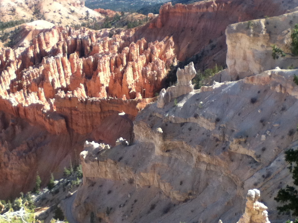
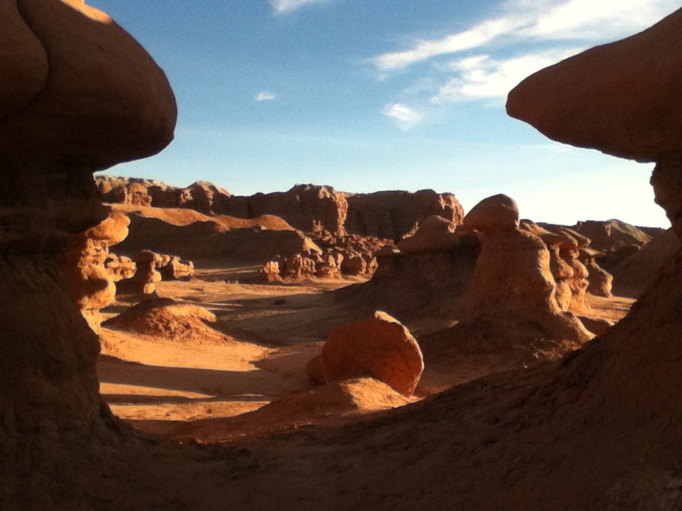
This place is sure to hit our top ten list this year. Unlike the tall spires that are only seen from above or below when you are “hoodooing” (like Bush, I reserve the right to make up words…) in Bryce Canyon, these hoodoos, called “Goblins” are human-sized, and mushroom shaped (….isn’t that a gracious way of saying, “phallic”?)


I felt like Alice in Wonderland walking among this valley floor covered with them.


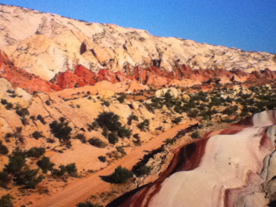
I have loaded up the goblin photos as I could not feature the other remarkable feature in this park, the complete darkness of the night sky here except for stars and planets and meteorites. Located just north of the Cathedral Valley in Capital Reef NP, this area down to Hovenweep is designated, a “dark sky reserve” as it lies more than 200 miles from the light array created by the large cities of Las Vegas and Salt Lake City. Stunning meteor displays allowed me to make LOTS of wishes for the election, global issues, and my son’s continuing success in college. This area was perfect for long evenings of campfire lounging.

The only disruption of our peaceful scene was Lety’s pursuit of nocturnal animals. Breaking 2 leashes and one collar lunging away from the fireside, we bought a choke chain (without sharp prongs) and heavy wire lead. She learned quickly to watch, not to lunge. Good dog. Smart dog. Nothing like a painful outcome to alter one’s behavior.

Old White Mountains Leer at Young Pink Rocks

Leaving Bryce Canyon on Scenic Byway 12, we drive 100 miles of designated, “All American Road”, one of only 10 such roads in the U.S. Crossing through 1.9 million acres of the last place in the continental U.S. to be mapped, we cruise by the last river to be mapped, the Escalante River. In 1872 while Powell’s 2nd Expedition mapped the Green and the Colorado Rivers, Powell’s sister, Botanist Ellen Thompson and her husband mapped the Escalante River and Henry Mountain.


While Bryce’s rocks formed its’ pink sandstone and limestone in a fresh water lake system 35-50 million years ago, they are relatively young. The rise of the Colorado Plateau 15-20 million years ago, exposed the sediment to erosion, forming fins and hoodoos. Capital Reef however, of harder Navajo Sandstone, is Permian rock, as old as 275 million years old and Cretaceous rock, as young as 80 million years old (…and does that make a 59 year old feel like a baby!) Maybe instead of getting old with phrases like, “60 is the new 50”, we should see our age as young compared with other “young” but enduring monuments. How about, “60 is the new 80 million”? Oh yeah, Baby, I am feeling like a young pink rock!)

I digress, back to geology…the Colorado Plateau that exposed young and old rocks is the largest monocline (stair step fold) in the U.S. No where better can this be seen than at the Waterpocket Fold in Capital Reef, running 90 miles in length, and exposing rocks standing 7,000 feet higher on the west side of the buried fault. The Chinle Formation exposed by the fold extends over most of the Colorado Plateau. It’s layers show massive sand dunes 190 million years ago, meandering and stagnant swamps 210 million years ago, and limestone formed when the area was covered by a shallow ocean 270 million years ago.


Although an older and richer display geologically than any site on the Plateau, hiking through the Grand Wash in the Waterpocket Fold as Rebecca and I did in the 80’s, is less dramatic visually than the massive monuments to the north in Cathedral Valley, rivaling Monument Valley in Navajo lands to the South.

HOW DO YOU HOODOO? (BRYCE CYN)

The hoodoos are formed when the “fins” or long ridges descending from the rim are subjected to erosion. Their red color is the result of the chemical iron oxide and water. Although very dry with only two streams in the park, small basins of water allow douglas fir to survive. The Claron Formation, providing the pink color, formed at the end of the Cretaceous Period, is exposed at Bryce. As the Colorado Plateau steps down, it exposes different formations with distinctive colors as the Plateau drops down toward the Colorado River.


John Wesley Powell led expeditions to map and name the dominant features in this area beginning in 1869, when he began a 3 month trip down the Green and Colorado Rivers and into the Grand Canyon. One of the boats, which held the barometers used for determining altitude was wrecked in the rapids below the Gates of Lador. He had to do a hazardous climb to rescue even one of the barometers. A wonderful book by Buzz Belknap follows the Powell Expedition on the Green River, rapid by rapid, based on Powell’s notes. Many years ago, I ran rivers, including the Green and the Grand Canyon. Powell’s accounts of the Marble and Lava rapids give you an idea of how dangerous 16 foot standing waves can be to a little boat. I recall the chills I felt as we we read his account within earshot of the rapids at the Gates of Lador the night before we ran it. He was a brave explorer and an exciting narrator:

“June 18, [Bradley and I] climb…until we have ascended 600-800 feet, when we are met by a sheer precipice…; Bradley hands the barometer to me,..I gain a foothold in a little crevice, and…I find I can get up no farther and cannot step back…I dare not let go with my hand…I call to Bradley for help. He…cannot reach me. The moment is critical…my muscles begin to tremble. At this moment it occurs to Bradley to take off his drawers…and swing them down to me. I hug close to the rock, let go with my hand, seize the dangling legs, and with his assistance am enabled to reach the top.”

He spent four years with the local Indians, recording their languages and way of life. They referred to him as, “Ka-puh-rats”, meaning, “Arm-off”. Powell lost his right arm in the civil war.


8300 foot elevation makes for high desert conditions(29 degrees at night, warm during the day) and animals including mountain lions, desert turtles, a prairie dog unique to this area, and of course the wily coyote. With Steven’s ankle still healing, we had hoped to trail ride below the rim to be among the hoodoos, but many park services have already closed for the winter, so this was the only horse we could arrange this late in the season.


STUMBLING THE NARROWS: ZION NAT’L PARK

The Colorado Plateau is a region raised very slowly, thousands of feet, exposing sedimentary layers that created the color variations and whose erosion created incredible variety of canyons and rock formations.  The Colorado Plateau is an immense area of land bordered on the south by the Sonoran and Painted Desert, on the west by the Great Basin of Nevada, on the east by the Rocky Mountains, and on the north by the Uinta Mountains of Utah. We are hiking and biking much of the 900 mile “Grand Circle, with focus on ruins of the Ancestral Puebloans, formerly called “The Anaszazi”, who have lived here for 10,000 years.

Deep in Zion Canyon, the Virgin River flows through a narrow canyon cut through the very hard substance, Navajo Sandstone, standing 2000 feet above the canyon floor. The sun rarely reaches the bottom of the canyon walls, narrowing to only 2o feet. It is a very cold and wet experience to wade up river. Prepared people wear wetsuits, neoprene booties, hiking boots and carry walking sticks.

In 1988 at Thanksgiving, my backpacking buddy Rebecca and I decided that hiking the 5 mile long Narrows in wet clothes, would make us hypothermic. No one was there (yeah, I know, I’ve said that before and been caught in the buff…) and we stripped to our unders and waded and swam the river, coming back to dry clothes. Given how much my feet hurt from the freezing water now in October, I think we either had intense mental toughness back then, or perhaps the numbness that protected my feet this time, was what allowed us to wade the river in more wintry conditions in the 80’s.

We enjoyed the long bike path that runs along the Virgin River. Another unique feature at Zion Canyon is the red macadam on the roads. At first I thought the red asphalt was based on the availability of local building material eg. red rocks=red highway materials. Not so. Someone actually thought to make the roads blend into the surroundings graciously. Within 500 feet of the canyon entry and exit, the roads revert to blacktop.