Monthly Archives: September 2014

ROCKIN’ THE ROCKIES: IN CANADA, NOT……the USA

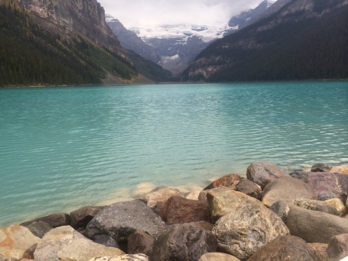
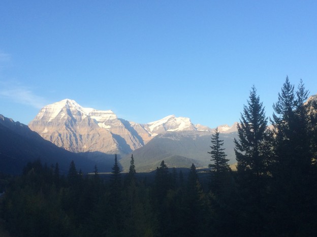
Is there such a thing as too many glacier photos? After three plus months way north, my mom more or less told me it was time to “move on” to other topics. But, but, but….Mt. Robson, the tallest peak in the Canadian Rockies is just too splendid not to show in our feature image. Jasper and Banff Parks offer still more dramatic glaciers (Lake Louise, below).

IMG_2182

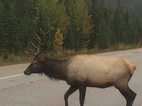
A pair of Elk on the road right in front of our bumper in Glacier National Park, put us closer than any wildlife sightings on this trip.  We greatly appreciate the highways designed with sod overpasses and miles of approaching highway fencing, keeping the large migrating herds of caribou from crossing the highways except at the sod bridges. Safer for all.

IMG_2169

Glacier National Park, Montana, USA will need to rename itself because it is so pathetically lacking in glaciers. We could have a national contest to rename it, “Pretty Nice Park”, or “Happy Animals Park”, so people will enjoy the fall colors, gorgeous waterfalls, and beautiful geologic formations…just not glaciers. With over 150 named glaciers 75 years ago, it is down to only 20 now, and park personnel predict none within a decade. Mostly you see little patches of dirty glacier surrounded by large fields of fine brown silt outlining where massive glacier-filled cirques used to be. We won’t admonish you to go now, instead will encourage you to drive due north to the Canadian Parks to see real glaciers.

IMG_2241

We continued driving south lingering in lovely Sandpoint and Coeur d’Alene, Idaho both with foodie attitude and good wines, and nice settings on the water…and finally headed west for the first time in two months,  only to discover our new ‘small city’ favorite…Spokane, in Eastern Washington. As the Spokane River flows through town, with lovely falls, great bridges and bike trails, we rode bikes to explore lots of outdoor art. With three universities and several large regional theatres (including the Bing Crosby), the town is jam packed with great food, and added cultural attractions for October’s “Art Month.” It feels like a big city (2nd largest in Washington with a population of 200,000) and a small town at the same time.

IMG_2262

We loved meeting these extras, just exiting the make-up trailer on a shoot near our hotel. What’s your guess, another Zombie movie…or just another day in Spokane?

IMG_2241

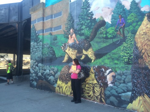
Spokane is a train town and they roll through, throughout the day and night. Many of the underpasses have become graffiti’d pee stops and homes for vagrants. In 1993, local artist Tom Quinn (www.quinntheartist.com) contributed a 20 ft. tall wall mural of oversized Hoary Marmots…and the Marmot became the town’s informal mascot. With time the mural faded and became obscured by bird poop and vandalism. Above is Tom’s replacement Marmot mural, painted at the City’s request this time, instead of as free form public expression.

IMG_2243

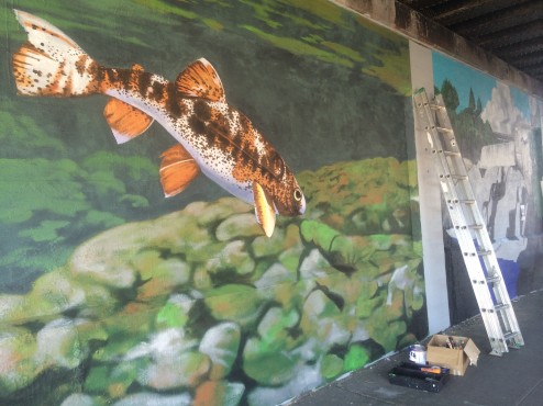
I happened on Tom painting new murals in the underpass and he was able to tell me the provenance of the murals (below) seen from our bed at the very groovy Ruby Hotel: muralist Ric Gendron. I am sorry I am not able to credit the creator of the wee bather in the adjoining wall sculpture or the muralist in the under pass at the bottom of the blog.

IMG_2261

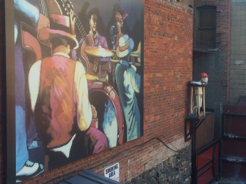
It took me a moment to figure out why the area’s designated Smoking Area seen above, specifically stated, “No Marijuana Smoking”. Duh. Recreational use of Marijuana is legal in Washington…but not in public spaces. The City of Seattle Police Chief last week dismissed 80% of the citations issued for public marijuana smoking, because it was the personal crusade of one officer who wrote all of those tickets. We’ve never been to Colorado or anywhere recreational marijuana is legally available to the general (over the age of 21) public. Of course, in our investigative journalistic quest, we visited a dispensary, only to find it…sold out! Darn! We were fantasizing about the brownies!

IMG_2265

Anyway, it is time to continue driving west, then south into other western states with old-fashioned rules about marijuana, and standard, ‘virgin’ fudge brownies…not that there’s anything wrong with them, as Seinfeld would say. We say, “All you need is love…la…la…la,la,la…”



THE ALASKA HIGHWAY: NOMENCLATURE

At the start of our trip we stated we were at the real “Mile Zero” for the AlCan Highway based on the theory prevalent in Weed, CA:  Hwy# 97 in Weed runs north as Hwy # 97 through Oregon, Washington, British Columbia, the Yukon, and Alaska, and parts of it are referred to by all jurisdictions as the Alaska or Al-Can Highway.

IMG_0329

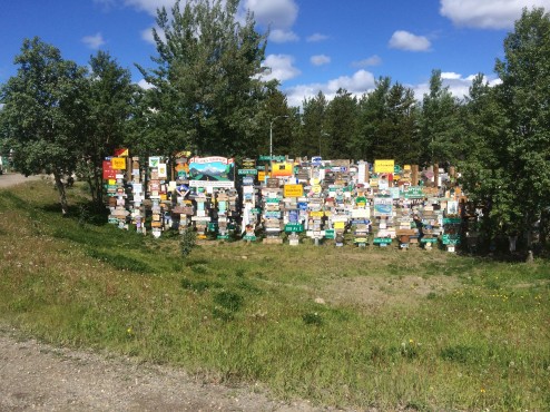
55,000 signs contributed by drivers on the AlCan Hwy in Watson Lake, BC, Canada.

Dawson Creek, British Columbia, Canada also claims to be “Mile Zero” for the Al-Can…as does Edmonton in the Alberta Province of Canada. Also Fairbanks, Alaska likes to claim it is the Northern Terminus of the Al-Can. So who are you to believe? Where is the real start and end of the Al-Can?

IMG_3129

It turns out the original AlCan was called the Alaskan Army Highway as it was built by the U.S. Military during WWII. In June of 1941 the Japanese Army invaded the Aleutian Islands in Alaska. It took a year for the American Army to begin a campaign to retake the Islands. That campaign has been called, “The Forgotten Battle” because it was occurring at the same time as the famous Battle for Guadalcanal. A supply route too far east to be reached by the Japanese Air Force, needed to be built. Long straight road surfaces were avoided to ensure that an invading air force could not strafe an entire convoy. Some of the original road was  improved and straightened once a defensive purpose was not part of the engineering goal.

IMG_3411

The crew who built the Alaskan Army Highway in 1942 had to build new road through the wilderness northward beginning in Fort St. John, because existing (rough) roads to Fort St. John from the South (Dawson Creek, BC) and the East (Edmonton, Alberta) were already in place, just needing improvements. The crew had to painstakingly build 1,422 miles of new road in only two years from Fort St. John all the way to Delta Junction, Alaska, where the road north to Fairbanks already existed.

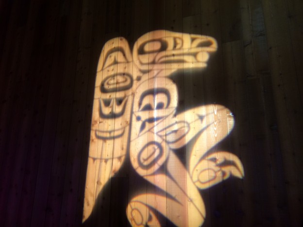
IMG_0330 I suggest we let the original road builders decide what is the starting point and the ending point of their construction. Although the building crew also IMPROVED the existing road up to Fairbanks, the road east to Edmonton, and the road south to Dawson Creek, the original crew would say “Mile Zero” began in “Zero”….their name for Fort St. John, likely the true southern terminus of the Alaskan Army Highway. The City of Weed, CA promised a matching totem pole at Delta Junction…but it is a myth…just some nice moose sightings just outside town.

IMG_3414

Only Fairbanks, Alaska disputes the identity of the Northern Terminus in Delta Junction. Again, for the road builders, their new road ended in Delta Junction; their work further north was just improvements made to existing road.

IMG_0757


LAND YACHT RIDES THE MARINE HIGHWAY: INSIDE PASSAGE-ALASKA

Change of plans.

IMG_1988

Travel fatigue kicked in at 3 months, instead of at the 13 month mark, like our last road trip. Is it because we couldn’t get satisfying access to a massive world heritage site we drove past for days and days, with few photos, and mediocre views, after steep hikes on rough terrain? Is it because our minds were blown every day with the dramatic Arctic scenery in Canada, followed by amazing wildlife, volcano and glacier viewing in Western Alaska so our EYES are tired…or is it the mass of biting insects (in their third hatch!) due to the especially wet summer?

IMG_1948We think the fatigue is probably explained by our bodies’ difficulty acclimatizing to 24 hours of sun all day and night in July at the Arctic Ocean, to Autumn’s freezing, dark nights with Aurora Borealis and howling wolves only 6 weeks…and thousands of road miles later, in August. Certainly our new rig with the queen size bed leaves no excuse for not sleeping well. Maybe we just need a daily dose of competitive tennis to keep us vibrant, and of course, there are few courts to be found in tiny Alaskan hamlets with long severe winters. When we find them, they are made of cracked asphalt (no cement in the land of the deep freeze), with barely visible lines, sagging nets, usually wet…and we love playing them anyway.

IMG_2106

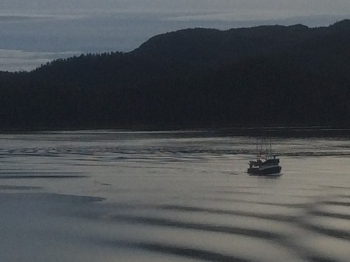
Whatever the reasons, we are taking a break from asphalt and gravel highways, opting for “free-style cruising” courtesy of the Alaska Marine Highway; at the last minute we jumped on a southbound ferry from Haines, Alaska without reservations to let the ship’s Captain do the driving. We have been driving our rig off ship to explore the towns, glaciers, hikes, and wildlife in the Inside Passage for days at a time, sharing the water with the early morning fishing boats.

IMG_2123

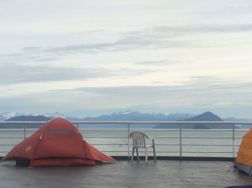
Although more expensive than driving our 23 mpg rig on the supposedly beautiful Cassiar Highway south, we’ve enjoyed daytime ferry travel with hot showers and kitchens to cook our food, and whales and porpoise pods for company as the ships travel through narrow steep fjords. On the overnight ferry trips, we have no access to our land yacht, and sleep out on the deck with other, usually younger, adventure travelers. So, who needs a cruise ship?

IMG_2133

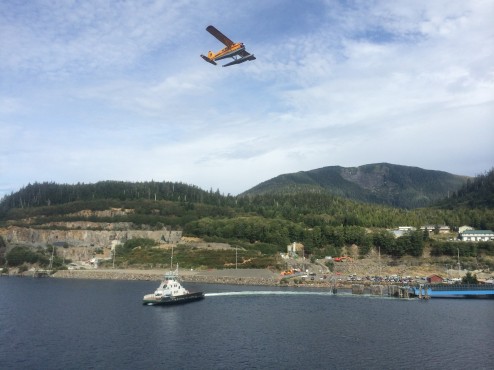
The towns of the Inside Passage are all year round commercial fishing villages, and seasonal tourist traps where the cruise ships visit. Yet they each have their unique charms: Ketchikan is the seaplane capital with aircraft, ferries and cruise ships sharing the waterfront above.

IMG_2062

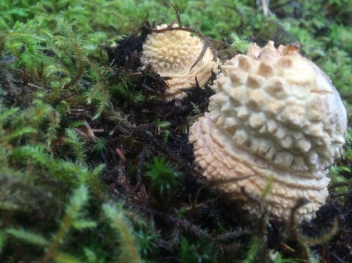
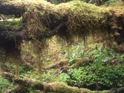
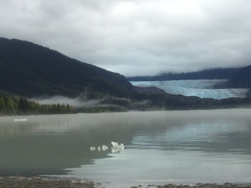
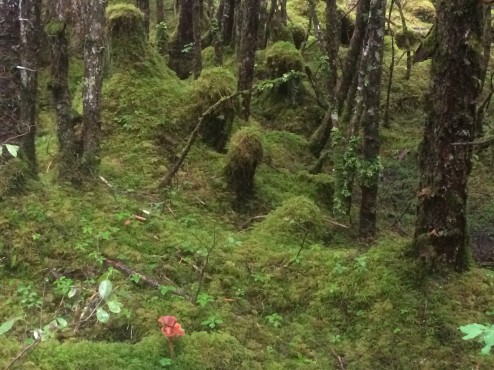
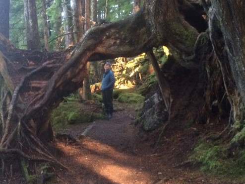
In Juneau, the Alaskan Capital, we enjoyed camping on an iceberg strewn lake before the Mendenhall Glacier at the edge of town (above)…but really, a State Capital with no railroad or road access? All of the Inside Passage is abutted by the Tongas National Park…dripping with rainforest. The hiking is extraordinarily beautiful, with lots of pesky bears fishing in the creeks (you don’t need a fancy tour to find sows and cubs chowing down!). All you need is your rain gear and your muck boots, to contend with the 55 inches of rain the area gets every October. You can see at the top and below, the happy mushrooms and furry green landscaped carpet.

IMG_2036

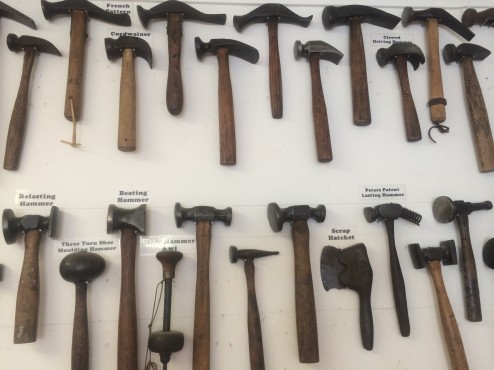
Some of these towns are weirder than other. We loved Haines, Alaska with the Hammer Museum, displaying a rock hammer used to build the Mycerinus Pyramid at Giza in 2500 B.C. When the rocks made of dolerite (hard, igneous rock) were used to cut blocks of softer limestone, they eventually chipped down to small round rocks themselves. Abandoned until archaeologists determined their purpose in a recent dig, one sits amid hammers for specific purposes like watch repair, horseshoeing, metal work, fire hydrant release, and animal husbandry, ones with printed names from nightclubs like the Cotton Club, given to patrons to “ding-ding” on their glasses for a fill. Thousands of them. Amazing collection by one passionate collector. Alaskans!

IMG_1898

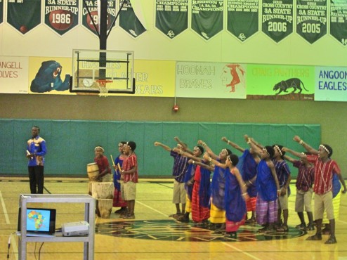
Our best experience in Haines was catching a performance of the African Children’s Choir from Uganda at the local public school our last morning. The school is a K-12, tiny, with only 20 graduating seniors each year. All the students seemed enthralled by the age 9-12 drummers, singers and dancers in kente cloth.

IMG_1908

Haines, Alaska raises funds for Africa’s Kilimanjaro Orphanage, founded by a local Haines physician and run by a Haines Board of Directors. Like the children at that orphanage, these performers have lost their parents to AIDS. After the one year tour of the U.S. and Canada, these children who have become like siblings to each other, will stay together at a boarding school for the duration of their childhood. Talented ambassadors for Uganda.

IMG_2069

In Prince Rupert, we will leave the marine highway, and Alaska, and take to the paved one, for the long ride home…we hope before the snow starts. There really is nowhere like Alaska where almost 90% of the state is dedicated to public land. We’ll be back.


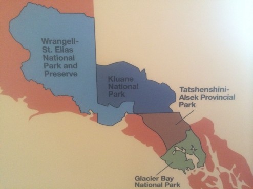
PROTECTED BY INACCESSIBILITY: KLUANE AND WRANGELL-ST.ELIAS NP

If you aren’t a long distance backpacker, climber, or kayaker, you can only touch the edges of these parks. Even a coastal assault does not provide easy access to the park interiors. Furthermore, taking hikes up slippery and steep, scree filled faces, from the perimeter roads, and then being able to see one small glaciers and one lower peak in the distance on each hike is more painful than pleasurable. However, driving for days down the paved highways along one long side of the extended three park World Heritage site, leaves us staggered by the enormity of these parks.

IMG_1777

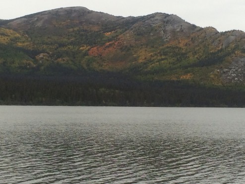
The most northern and the largest park in our National Park System, Wrangell-St. Elias NP contains 13,000 square miles of untouched wilderness. It is also the largest glacial system in North America, 25% of it covered by glaciers. 7 out of 10 of our largest U.S. parks are in Alaska. Mt. St. Elias, only 10 miles from tidewater, is only 600 feet lower than Denali, the highest mountain on the continent. The Bagley Icefield in the interior represents 60% of all ice-covered terrain in Alaska. Although the Park has World Heritage Site status, it is currently not a draw to tourists, given the access issues. Long, pot-holed dirt roads get you to one small glacier, but not to views of the ice fields and tall peaks we want to see. Not that glacial lakes aren’t a pretty place to camp…

IMG_1846

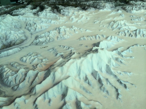
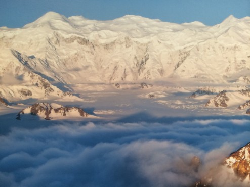
However, our biggest disappointment was not being able to see Mt. Logan in Canada’s Kluane Park (pronounced “cloo-AH-nee) . Mt. Logan is the highest peak in the largest massif mountain structure in the world. It can be seen best in the featured image of a relief map of the massif, and also in the uncredited flight-seeing photo below. It has the largest base circumference of any non-volcanic mountain on Earth. It is over 12 miles long and has over 200 glaciers. It contains 11 peaks over 16,500 feet…and the mountain is still rising. It is frozen year round, leaving an ice cap 1,000 feet thick in places. In geology, a massif is a section of the planet’s crust that retains its internal structure while being displaced as a whole. The Swiss Alps and Himalayas containing Mt. Everest are an example of these massifs, as is ‘The Face’…on Mars. Again, the World Heritage Site designation is not a draw for tourists so long as access is so limited. Just to give you a sense of our frustration, the Mt. Logan massif is not visible from ANY perimeter road, no matter how clear the weather.  Only 2,000 feet taller, Denali can be seen most clear days from Anchorage to Fairbanks. This massive beast requires good weather AND an airplane. We had neither.  “Grrrrr!”

IMG_1849

The next Park to the South is the Tatshenshini-Alsek which is accessible by river. Running “The Tat”, is something we’ve heard river running friends talk about for years…big Class 4 waves and very cold water in deep wilderness, as the two eponymous rivers meet up. Again, you have to commit yourself to a 10 day or so rugged trip to enjoy the interior of these parks. The most frustrating experience is being unable to see, much less shoot cognizable photos of these amazing peaks due to poor weather and poor accessibility. I guess we just have to return, not during the rainy season, and when we are ready to commit 10 days to adventure travel…in each one of these parks.